
Hubbard Glacier topographic map
Interactive map
Click on the map to display elevation.
Hubbard Glacier
The longest source for Hubbard Glacier originates 122 kilometres (76 mi) from its snout and is located at about 61°00′N 140°09′W / 61.000°N 140.150°W / 61.000; -140.150, approximately 8 kilometres (5 mi) west of Mount Walsh with an elevation around 3,400 metres (11,200 ft). A shorter tributary glacier begins at the easternmost summit on the Mount Logan ridge at about 5,600 metres (18,400 ft) at about 60°35′0″N 140°22′40″W / 60.58333°N 140.37778°W / 60.58333; -140.37778.
About this map
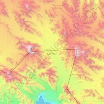
Name: Hubbard Glacier topographic map, elevation, terrain.
Location: Hubbard Glacier, Yakutat, Alaska, United States (59.98639 -139.64438 60.67720 -138.78555)
Average elevation: 1,892 m
Minimum elevation: 0 m
Maximum elevation: 4,763 m
Other topographic maps
Click on a map to view its topography, its elevation and its terrain.