
Cerro de San Miguel topographic map
Interactive map
Click on the map to display elevation.
About this map
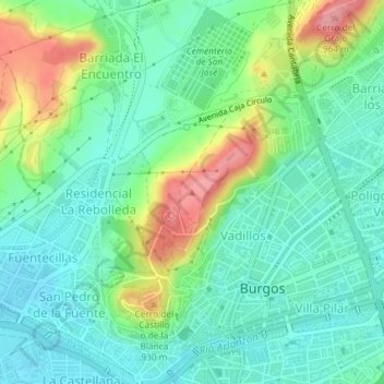
Name: Cerro de San Miguel topographic map, elevation, terrain.
Location: Cerro de San Miguel, Burgos, Castilla y León, 09071, España (42.35059 -3.70369 42.35069 -3.70359)
Average elevation: 883 m
Minimum elevation: 849 m
Maximum elevation: 958 m
Other topographic maps
Click on a map to view its topography, its elevation and its terrain.
Distrito Sur
España > Castilla y León > Burgos
Distrito Sur, Burgos, Castilla y León, España
Average elevation: 889 m