
Clarenville topographic map
Interactive map
Click on the map to display elevation.
Clarenville
The Clarenville area has many of the physical features characteristic of the East Coast of Newfoundland and has a marine climate. It lies along the coastal slopes which rise from the Atlantic Ocean towards the interior central plateau of the island. The dominating physical feature is a ridge of broken peaks which rise to heights up to 152 meters above sea level parallel to the coast line. Bare Mountain, with an elevation of 156 meters above sea level, dominates the skyline in the northern part of the town. This ridge falls sharply towards the sea so that its coastal edge is characterized by moderate to severe slopes.
About this map
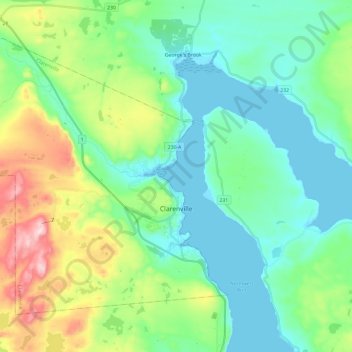
Name: Clarenville topographic map, elevation, terrain.
Location: Clarenville, Newfoundland, Newfoundland and Labrador, Canada (48.12058 -54.16624 48.24394 -53.93048)
Average elevation: 102 m
Minimum elevation: 0 m
Maximum elevation: 399 m
Other topographic maps
Click on a map to view its topography, its elevation and its terrain.