
Thank you for supporting this site ❤️
Make a donation
Make a donation
Kohi topographic map
Click on the map to display elevation.
Thank you for supporting this site ❤️
Make a donation
Make a donation
About this map
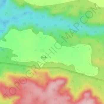
Name: Kohi topographic map, elevation, terrain.
Location: Kohi, Chikhaldara, Amravati District, Maharashtra, India (21.68048 77.25770 21.69324 77.28835)
Average elevation: 460 m
Minimum elevation: 369 m
Maximum elevation: 571 m
Thank you for supporting this site ❤️
Make a donation
Make a donation
Other topographic maps
Click on a map to view its topography, its elevation and its terrain.