
Rienzenstock topographic map
Interactive map
Click on the map to display elevation.
About this map
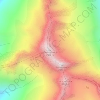
Name: Rienzenstock topographic map, elevation, terrain.
Location: Rienzenstock, Gurtnellen, Uri, 6484, Schweiz (46.68302 8.63569 46.68312 8.63579)
Average elevation: 2,387 m
Minimum elevation: 1,719 m
Maximum elevation: 2,936 m
Other topographic maps
Click on a map to view its topography, its elevation and its terrain.
Bächenstock
Schweiz > Uri > Gurtnellen
Bächenstock, Gurtnellen, Uri, 6484, Schweiz
Average elevation: 2,428 m