
Thank you for supporting this site ❤️
Make a donation
Make a donation
Gubadli topographic map
Click on the map to display elevation.
Thank you for supporting this site ❤️
Make a donation
Make a donation
About this map
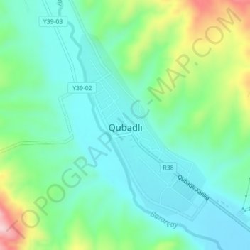
Name: Gubadli topographic map, elevation, terrain.
Location: Gubadli, Qubadli District, East Zangezur, Azerbaijan (39.33396 46.57452 39.35371 46.59227)
Average elevation: 535 m
Minimum elevation: 465 m
Maximum elevation: 725 m
Thank you for supporting this site ❤️
Make a donation
Make a donation
Other topographic maps
Click on a map to view its topography, its elevation and its terrain.