
Thank you for supporting this site ❤️
Make a donation
Make a donation
Jabrayil District topographic map
Click on the map to display elevation.
Thank you for supporting this site ❤️
Make a donation
Make a donation
About this map
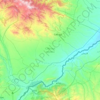
Name: Jabrayil District topographic map, elevation, terrain.
Location: Jabrayil District, East Zangezur, Azerbaijan (39.13941 46.68777 39.49833 47.32205)
Average elevation: 625 m
Minimum elevation: 156 m
Maximum elevation: 2,442 m
Thank you for supporting this site ❤️
Make a donation
Make a donation
Other topographic maps
Click on a map to view its topography, its elevation and its terrain.