
New Westminster topographic map
Click on the map to display elevation.
About this map
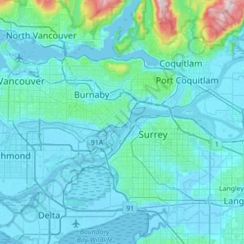
Name: New Westminster topographic map, elevation, terrain.
Average elevation: 87 m
Minimum elevation: -4 m
Maximum elevation: 1,192 m
Other topographic maps
Click on a map to view its topography, its elevation and its terrain.
Mount Pleasant
Canada > British Columbia > Metro Vancouver Regional District > Vancouver
Average elevation: 28 m
Bowen Island Municipality
Canada > British Columbia > Metro Vancouver Regional District
Average elevation: 95 m
Coquitlam
Canada > British Columbia > Metro Vancouver Regional District
Like much of Metro Vancouver, Coquitlam has an oceanic climate (Köppen climate type Cfb), experiencing mild temperatures and high precipitation; warm, dry summers and cool, wet winters. However, compared to most other cities in the area, precipitation is especially heavy in Coquitlam due to its proximity to…
Average elevation: 190 m