
Edison topographic map
Interactive map
Click on the map to display elevation.
About this map
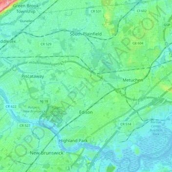
Name: Edison topographic map, elevation, terrain.
Location: Edison, Middlesex County, New Jersey, United States (40.47080 -74.44032 40.60550 -74.31605)
Average elevation: 24 m
Minimum elevation: -3 m
Maximum elevation: 111 m
While the Township's topography is mostly flat, there are some more hilly areas in the township. The highest point is on Grandview Avenue, which reaches a maximum elevation of about 220 feet, which is the highest point in the Township. The lowest elevation in the township is on sea level on the Raritan River.
Other topographic maps
Click on a map to view its topography, its elevation and its terrain.
Jamesburg
United States > New Jersey > Middlesex County
Jamesburg, Middlesex County, New Jersey, United States
Average elevation: 25 m