
Loveland topographic map
Interactive map
Click on the map to display elevation.
About this map
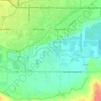
Name: Loveland topographic map, elevation, terrain.
Average elevation: 1,502 m
Minimum elevation: 1,480 m
Maximum elevation: 1,543 m
Other topographic maps
Click on a map to view its topography, its elevation and its terrain.
Estes Park
Vereinigte Staaten von Amerika > Colorado > Larimer County > Estes Park > Estes Park
Estes Park, Larimer County, Colorado, 80517, Vereinigte Staaten von Amerika
Average elevation: 2,461 m