
Estes Park topographic map
Interactive map
Click on the map to display elevation.
About this map
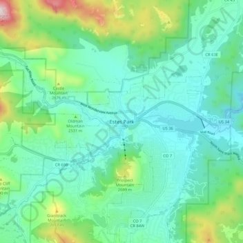
Name: Estes Park topographic map, elevation, terrain.
Average elevation: 2,461 m
Minimum elevation: 2,247 m
Maximum elevation: 3,186 m
Die Stadt wurde nach Joel Estes benannt, der Estes Park 1859 gründete. Sie liegt in einem Tal in 2293 m Höhe über dem Meeresspiegel. Im Sommer ist sie ein beliebter Ausflugsort mit zahlreichen Touristengeschäften und Hauptzugang für den Rocky Mountain National Park.