
Ma'oputasi County topographic map
Interactive map
Click on the map to display elevation.
About this map
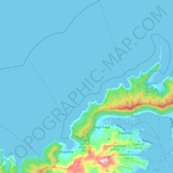
Name: Ma'oputasi County topographic map, elevation, terrain.
Average elevation: 50 m
Minimum elevation: -2 m
Maximum elevation: 595 m
Other topographic maps
Click on a map to view its topography, its elevation and its terrain.
Olosega
American Samoa > American Samoa > Olosega
Olosega, Olosega County, American Samoa
Average elevation: 16 m