
Olosega topographic map
Interactive map
Click on the map to display elevation.
About this map
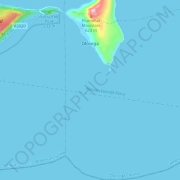
Name: Olosega topographic map, elevation, terrain.
Location: Olosega, Olosega County, American Samoa (-14.23792 -169.63165 -14.16394 -169.56791)
Average elevation: 16 m
Minimum elevation: -1 m
Maximum elevation: 556 m