
Kondar topographic map
Interactive map
Click on the map to display elevation.
About this map
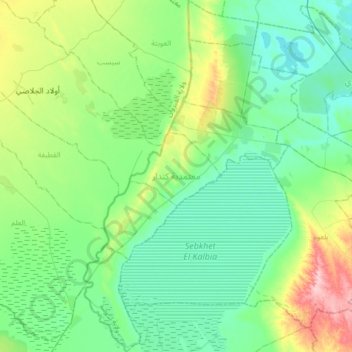
Name: Kondar topographic map, elevation, terrain.
Location: Kondar, Sousse, 4020, Tunisie (35.77081 10.15850 36.03565 10.36577)
Average elevation: 41 m
Minimum elevation: 3 m
Maximum elevation: 160 m
Other topographic maps
Click on a map to view its topography, its elevation and its terrain.
El Kalaa Essghira Est
El Kalaa Essghira Est, Kalaa Sghira, Sousse, 4021, Tunisie
Average elevation: 45 m