Geolocate

Berg topographic map

Click on the map to display elevation.

About this map
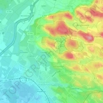
Name: Berg topographic map, elevation, terrain.

Location: Berg, Kressbronn am Bodensee, Verwaltungsverband Eriskirch-Kressbronn am Bodensee-Langenargen, Bodenseekreis, Baden-Württemberg, 88079, Germany (47.58894 9.58478 47.62894 9.62478)

Average elevation: 443 m

Minimum elevation: 396 m

Maximum elevation: 530 m

Other topographic maps

Click on a map to view its topography, its elevation and its terrain.

Tettnang

Germany > Baden-Württemberg > Bodenseekreis

Average elevation: 457 m

Tettnang

Germany > Baden-Württemberg > Bodenseekreis

Average elevation: 457 m