
Yangnim-dong topographic map
Interactive map
Click on the map to display elevation.
About this map
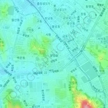
Name: Yangnim-dong topographic map, elevation, terrain.
Location: Yangnim-dong, Nam-gu, Gwangju, 61662, South Korea (35.13437 126.90867 35.14298 126.92031)
Average elevation: 62 m
Minimum elevation: 38 m
Maximum elevation: 182 m
Other topographic maps
Click on a map to view its topography, its elevation and its terrain.