
Dong-gu topographic map
Interactive map
Click on the map to display elevation.
About this map
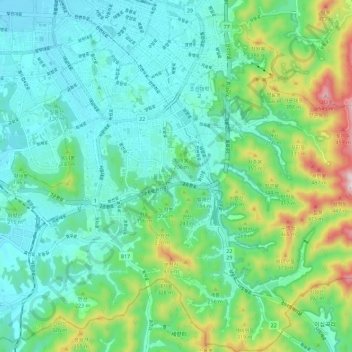
Name: Dong-gu topographic map, elevation, terrain.
Location: Dong-gu, Gwangju, South Korea (35.07233 126.90721 35.16546 127.00425)
Average elevation: 153 m
Minimum elevation: 23 m
Maximum elevation: 559 m
Other topographic maps
Click on a map to view its topography, its elevation and its terrain.