
Waal topographic map
Interactive map
Click on the map to display elevation.
About this map
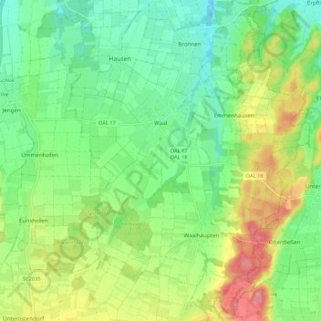
Name: Waal topographic map, elevation, terrain.
Location: Waal, Buchloe, Landkreis Ostallgäu, Beieren, 86875, Duitsland (47.95140 10.74482 48.02290 10.82638)
Average elevation: 651 m
Minimum elevation: 613 m
Maximum elevation: 716 m
Other topographic maps
Click on a map to view its topography, its elevation and its terrain.
Lechbruck a.See
Duitsland > Beieren > Landkreis Ostallgäu > Lechbruck a.See
Lechbruck a.See, Landkreis Ostallgäu, Beieren, 86983, Duitsland
Average elevation: 772 m
Füssen
Duitsland > Beieren > Landkreis Ostallgäu
Füssen, Landkreis Ostallgäu, Beieren, 87629, Duitsland
Average elevation: 852 m