
Thirunavaya topographic map
Interactive map
Click on the map to display elevation.
About this map
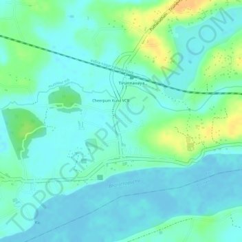
Name: Thirunavaya topographic map, elevation, terrain.
Location: Thirunavaya, Tirur, Malappuram, Kerala, India (10.86710 75.98113 10.87310 75.98785)
Average elevation: 10 m
Minimum elevation: -3 m
Maximum elevation: 34 m
Other topographic maps
Click on a map to view its topography, its elevation and its terrain.
Varambanala
India > Kerala > Tirur > Kadungathukundu
Varambanala, Kadungathukundu, Tirur, Malappuram District, Kerala, 676551, India
Average elevation: 45 m
Kuttippuram
Kuttippuram, Tirur, Malappuram District, Kerala, 679571, India
Average elevation: 26 m
Valanchery
Valanchery, Tirur, Malappuram, Kerala, 676552, India
Average elevation: 46 m