
Husby topographic map
Interactive map
Click on the map to display elevation.
About this map
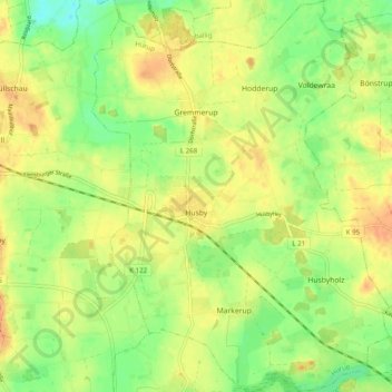
Name: Husby topographic map, elevation, terrain.
Location: Husby, Hürup, Schleswig-Flensburg, Sleeswijk-Holstein, Duitsland (54.73997 9.55236 54.79656 9.62693)
Average elevation: 44 m
Minimum elevation: 23 m
Maximum elevation: 61 m
Other topographic maps
Click on a map to view its topography, its elevation and its terrain.
Steinberg
Duitsland > Sleeswijk-Holstein > Schleswig-Flensburg
Steinberg, Geltinger Bucht, Schleswig-Flensburg, Sleeswijk-Holstein, Duitsland
Average elevation: 15 m