
Steinberg topographic map
Interactive map
Click on the map to display elevation.
About this map
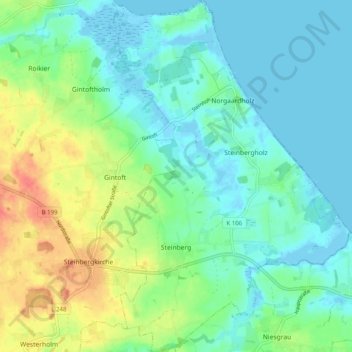
Name: Steinberg topographic map, elevation, terrain.
Average elevation: 15 m
Minimum elevation: -5 m
Maximum elevation: 51 m
Other topographic maps
Click on a map to view its topography, its elevation and its terrain.
Husby
Duitsland > Sleeswijk-Holstein > Schleswig-Flensburg
Husby, Hürup, Schleswig-Flensburg, Sleeswijk-Holstein, Duitsland
Average elevation: 44 m