
Thank you for supporting this site ❤️
Make a donation
Make a donation
Rebild topographic map
Click on the map to display elevation.
Thank you for supporting this site ❤️
Make a donation
Make a donation
About this map
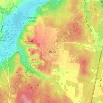
Name: Rebild topographic map, elevation, terrain.
Location: Rebild, Rebild Kommune, Jutland du Nord, Danemark (56.81134 9.82950 56.85134 9.86950)
Average elevation: 61 m
Minimum elevation: 3 m
Maximum elevation: 110 m
Thank you for supporting this site ❤️
Make a donation
Make a donation
Other topographic maps
Click on a map to view its topography, its elevation and its terrain.