
Thank you for supporting this site ❤️
Make a donation
Make a donation
Rebild Bakker topographic map
Click on the map to display elevation.
Thank you for supporting this site ❤️
Make a donation
Make a donation
About this map
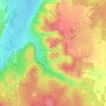
Name: Rebild Bakker topographic map, elevation, terrain.
Location: Rebild Bakker, Rebild, Rebild Kommune, Jutland du Nord, Danemark (56.82061 9.82406 56.83687 9.84953)
Average elevation: 60 m
Minimum elevation: 4 m
Maximum elevation: 102 m
Thank you for supporting this site ❤️
Make a donation
Make a donation