
Thank you for supporting this site ❤️
Make a donation
Make a donation
Brædstrup topographic map
Click on the map to display elevation.
Thank you for supporting this site ❤️
Make a donation
Make a donation
About this map
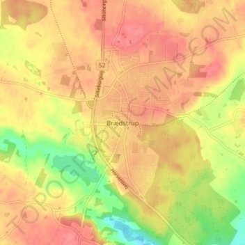
Name: Brædstrup topographic map, elevation, terrain.
Location: Brædstrup, Horsens Kommune, Jutland central, 8740, Danemark (55.95225 9.59009 55.99225 9.63009)
Average elevation: 107 m
Minimum elevation: 63 m
Maximum elevation: 132 m
Thank you for supporting this site ❤️
Make a donation
Make a donation
Other topographic maps
Click on a map to view its topography, its elevation and its terrain.