
Waxhaw topographic map
Interactive map
Click on the map to display elevation.
About this map
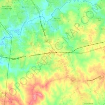
Name: Waxhaw topographic map, elevation, terrain.
Location: Waxhaw, Union County, North Carolina, 28173, United States (34.88481 -80.78402 34.96481 -80.70402)
Average elevation: 187 m
Minimum elevation: 150 m
Maximum elevation: 236 m
Other topographic maps
Click on a map to view its topography, its elevation and its terrain.