
Thank you for supporting this site ❤️
Make a donation
Make a donation
Monroe topographic map
Click on the map to display elevation.
Thank you for supporting this site ❤️
Make a donation
Make a donation
About this map
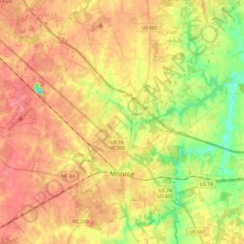
Name: Monroe topographic map, elevation, terrain.
Location: Monroe, Union County, North Carolina, United States (34.94438 -80.64794 35.08662 -80.47525)
Average elevation: 181 m
Minimum elevation: 134 m
Maximum elevation: 217 m
Thank you for supporting this site ❤️
Make a donation
Make a donation
Other topographic maps
Click on a map to view its topography, its elevation and its terrain.