
Salem topographic map
Interactive map
Click on the map to display elevation.
About this map
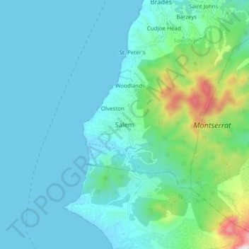
Name: Salem topographic map, elevation, terrain.
Location: Salem, Saint Peter, Montserrat (16.70956 -62.26098 16.78956 -62.18098)
Average elevation: 142 m
Minimum elevation: -2 m
Maximum elevation: 892 m
Other topographic maps
Click on a map to view its topography, its elevation and its terrain.
Friths
Montserrat > Saint Peter > Salem > Friths
Friths, Salem, Saint Peter, Montserrat
Average elevation: 159 m