
Thank you for supporting this site ❤️
Make a donation
Make a donation
Lake Wateree topographic map
Click on the map to display elevation.
Thank you for supporting this site ❤️
Make a donation
Make a donation
About this map
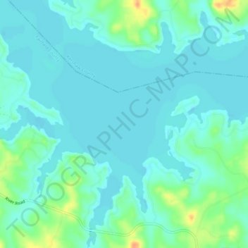
Name: Lake Wateree topographic map, elevation, terrain.
Location: Lake Wateree, Kershaw County, South Carolina, United States (34.38781 -80.85292 34.42594 -80.81107)
Average elevation: 76 m
Minimum elevation: 67 m
Maximum elevation: 106 m
Thank you for supporting this site ❤️
Make a donation
Make a donation
Other topographic maps
Click on a map to view its topography, its elevation and its terrain.