
Shiroda topographic map
Interactive map
Click on the map to display elevation.
About this map
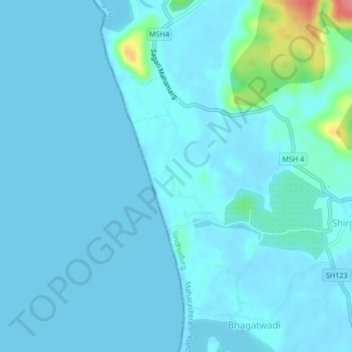
Name: Shiroda topographic map, elevation, terrain.
Location: Shiroda, Vengurla, Sindhudurg, Maharashtra, 416518, India (15.75521 73.64255 15.79521 73.68255)
Average elevation: 7 m
Minimum elevation: -2 m
Maximum elevation: 78 m
Other topographic maps
Click on a map to view its topography, its elevation and its terrain.
Redi
India > Maharashtra > Vengurla > Redi
Redi, Vengurla, Sindhudurg, Maharashtra, 416517, India
Average elevation: 5 m