
Madaba topographic map
Interactive map
Click on the map to display elevation.
About this map
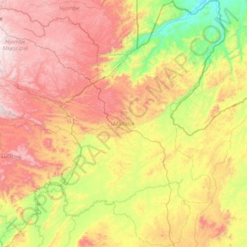
Name: Madaba topographic map, elevation, terrain.
Location: Madaba, Ruvuma, Südhochlandzone, Tansania (-10.48063 35.10640 -9.25038 35.94670)
Average elevation: 1,031 m
Minimum elevation: 314 m
Maximum elevation: 2,121 m
Other topographic maps
Click on a map to view its topography, its elevation and its terrain.