
Chad Lake topographic map
Interactive map
Click on the map to display elevation.
About this map
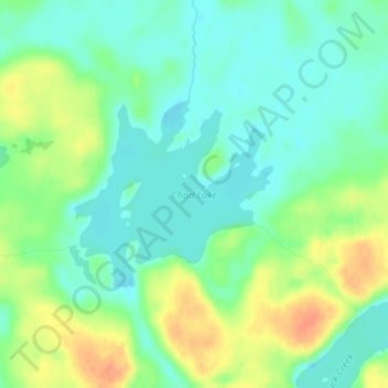
Name: Chad Lake topographic map, elevation, terrain.
Location: Chad Lake, Saint Louis County, Minnesota, USA (47.96637 -92.23489 47.97939 -92.21421)
Average elevation: 441 m
Minimum elevation: 426 m
Maximum elevation: 466 m
Other topographic maps
Click on a map to view its topography, its elevation and its terrain.
Lake Harriet
USA > Minnesota > Minneapolis
Lake Harriet, Lake Harriet Bike Trail, Lynnhurst, Minneapolis, Hennepin County, Minnesota, 55410, USA
Average elevation: 268 m
Keller Lake
Keller Lake, North Maplewood Drive, Maplewood, Ramsey County, Minnesota, 55109, USA
Average elevation: 272 m
Current Lake
USA > Minnesota > Current Lake
Current Lake, Murray County, Minnesota, USA
Average elevation: 511 m
Alexandria
USA > Minnesota > Alexandria
Alexandria, Douglas County, Minnesota, 56308, USA
Average elevation: 426 m