
Thank you for supporting this site ❤️
Make a donation
Make a donation
Jimma topographic map
Click on the map to display elevation.
Thank you for supporting this site ❤️
Make a donation
Make a donation
About this map
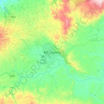
Name: Jimma topographic map, elevation, terrain.
Location: Jimma, Oromia Region, Ethiopia (7.51562 36.68788 7.83562 37.00788)
Average elevation: 1,910 m
Minimum elevation: 1,575 m
Maximum elevation: 2,778 m
Thank you for supporting this site ❤️
Make a donation
Make a donation
Other topographic maps
Click on a map to view its topography, its elevation and its terrain.