
Palpora topographic map
Interactive map
Click on the map to display elevation.
About this map
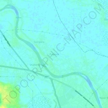
Name: Palpora topographic map, elevation, terrain.
Average elevation: 1,584 m
Minimum elevation: 1,580 m
Maximum elevation: 1,598 m
Other topographic maps
Click on a map to view its topography, its elevation and its terrain.
Srinagar
India > Jammu and Kashmir > Srinagar (South)
Srinagar, Srinagar (South), Srinagar District, Jammu and Kashmir, 190001, India
Average elevation: 1,805 m
Zabarwan Park
India > Jammu and Kashmir > Srinagar (South) > Srinagar
Zabarwan Park, Srinagar, Srinagar (South), Srinagar District, Jammu and Kashmir, 190003, India
Average elevation: 1,616 m