
St. Ingbert-Mitte topographic map
Interactive map
Click on the map to display elevation.
About this map
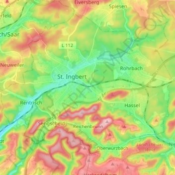
Name: St. Ingbert-Mitte topographic map, elevation, terrain.
Average elevation: 292 m
Minimum elevation: 202 m
Maximum elevation: 407 m
Other topographic maps
Click on a map to view its topography, its elevation and its terrain.
Sengscheid
Deutschland > Saarland > St. Ingbert
Sengscheid, St. Ingbert, Saarpfalz-Kreis, Saarland, Deutschland
Average elevation: 303 m