
Dagdas novads topographic map
Interactive map
Click on the map to display elevation.
About this map
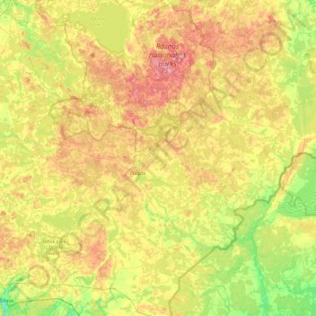
Name: Dagdas novads topographic map, elevation, terrain.
Location: Dagdas novads, Latgale, Letland (55.97470 27.21125 56.26170 28.09586)
Average elevation: 167 m
Minimum elevation: 94 m
Maximum elevation: 275 m
Other topographic maps
Click on a map to view its topography, its elevation and its terrain.
Priedaine
Letland > Latgale > Krāslavas novads > Krāslava
Priedaine, Krāslava, Krāslavas novads, Latgale, LV-5601, Letland
Average elevation: 129 m
Indrica
Letland > Latgale > Krāslavas novads
Indrica, Krāslavas novads, Latgale, Letland
Average elevation: 157 m
Saulkrasti
Letland > Latgale > Saulkrasti
Saulkrasti, Krāslavas novads, Latgale, Letland
Average elevation: 132 m