
Thank you for supporting this site ❤️
Make a donation
Make a donation
Clay County topographic map
Click on the map to display elevation.
Thank you for supporting this site ❤️
Make a donation
Make a donation
About this map
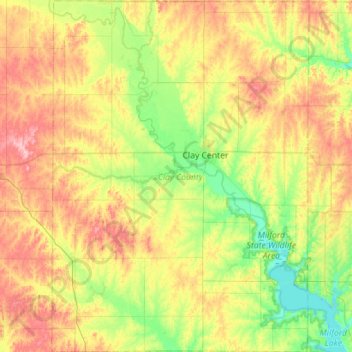
Name: Clay County topographic map, elevation, terrain.
Location: Clay County, Kansas, United States (39.13196 -97.37115 39.56779 -96.95872)
Average elevation: 397 m
Minimum elevation: 345 m
Maximum elevation: 475 m
Thank you for supporting this site ❤️
Make a donation
Make a donation
Other topographic maps
Click on a map to view its topography, its elevation and its terrain.