
Woodlands topographic map
Interactive map
Click on the map to display elevation.
About this map
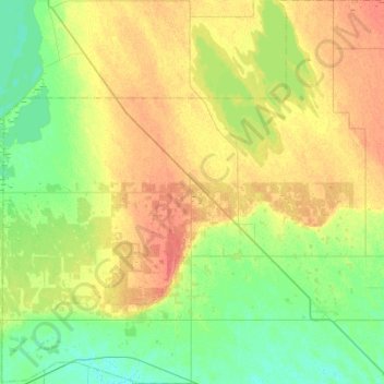
Name: Woodlands topographic map, elevation, terrain.
Location: Woodlands, Manitoba, Canada (50.06363 -98.00903 50.41863 -97.45962)
Average elevation: 258 m
Minimum elevation: 243 m
Maximum elevation: 280 m