
Ahlen topographic map
Interactive map
Click on the map to display elevation.
About this map
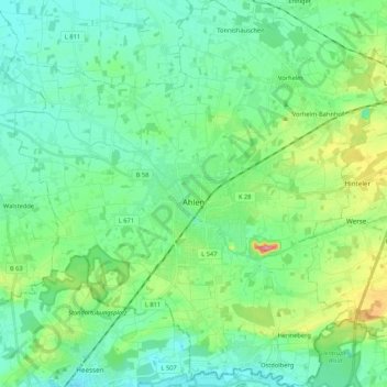
Name: Ahlen topographic map, elevation, terrain.
Location: Ahlen, Kreis Warendorf, Noordrijn-Westfalen, Duitsland (51.70014 7.78820 51.83131 7.99161)
Average elevation: 81 m
Minimum elevation: 57 m
Maximum elevation: 157 m
Other topographic maps
Click on a map to view its topography, its elevation and its terrain.
Alverskirchen
Duitsland > Noordrijn-Westfalen > Kreis Warendorf
Alverskirchen, Everswinkel, Kreis Warendorf, Noordrijn-Westfalen, 48351, Duitsland
Average elevation: 61 m
Beckum
Duitsland > Noordrijn-Westfalen > Kreis Warendorf > Beckum
Beckum, Kreis Warendorf, Noordrijn-Westfalen, 59269, Duitsland
Average elevation: 110 m