
Thank you for supporting this site ❤️
Make a donation
Make a donation
Nybster topographic map
Click on the map to display elevation.
Thank you for supporting this site ❤️
Make a donation
Make a donation
About this map
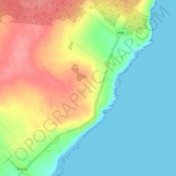
Name: Nybster topographic map, elevation, terrain.
Location: Nybster, Highland, Scotland, KW1 4XR, United Kingdom (58.53343 -3.11489 58.57343 -3.07489)
Average elevation: 30 m
Minimum elevation: 0 m
Maximum elevation: 77 m
Thank you for supporting this site ❤️
Make a donation
Make a donation
Other topographic maps
Click on a map to view its topography, its elevation and its terrain.
Glen Coe
United Kingdom > Scotland > Highland > Glencoe
Habitats within Glen Coe include birch woodland, moorland and peatbogs. The upland parts of the glen are one of the best habitats for alpine and sub-alpine plants in Lochaber, due to the underlying geology and range of altitude. Typical plants found on the highest slopes of the glen include lady's…
Average elevation: 414 m
Thank you for supporting this site ❤️
Make a donation
Make a donation