
Make a donation
Mountain Center topographic map
Click on the map to display elevation.
Make a donation
Mountain Center
It lies centered on the junction of State Route 74 and State Route 243 in the southern division of San Bernardino National Forest. Mountain Center lies just north of Lake Hemet, midway between Hemet and Palm Desert, just south of the town of Idyllwild, and it is southeast of the city of Riverside, the county seat of Riverside County. Its elevation is 4,518 feet (1,377 m). Although Mountain Center is unincorporated, it has a post office, with the ZIP code of 92561.
Make a donation
About this map
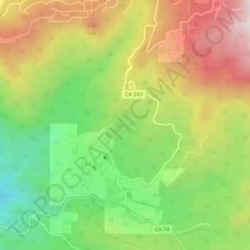
Name: Mountain Center topographic map, elevation, terrain.
Average elevation: 1,476 m
Minimum elevation: 1,159 m
Maximum elevation: 1,842 m
Make a donation
Other topographic maps
Click on a map to view its topography, its elevation and its terrain.
Menifee
United States > California > Riverside County
The city is centrally located in Southern California in the Menifee Valley. It is almost 15 miles (24 km) north of Temecula and just north of Murrieta. Menifee is roughly 46 square miles (100 km2) in size and has an elevation of 1,424 feet (434 m). The incorporated City of Menifee includes the communities of…
Average elevation: 474 m
Indio
United States > California > Riverside County > Indio
Indio is home of Riverside County's eastern administration offices. Palm Springs had more people from 1955 to 1992, when the US census announced that Indio surpassed Palm Springs and that title was returned to them. The official elevation of Indio is below sea level; the city hall is 14 feet (4 m) below sea…
Average elevation: 70 m
Make a donation
Palm Springs
United States > California > Riverside County > Palm Springs
One possible origin of palm in the place name comes from early Spanish explorers who referred to the area as La Palma de la Mano de Dios or "The Palm of God's hand". The earliest use of the name "Palm Springs" is from United States Topographical Engineers who used the term in 1853 maps. According to William…
Average elevation: 698 m