Sugden topographic map
Interactive map
Click on the map to display elevation.
About this map
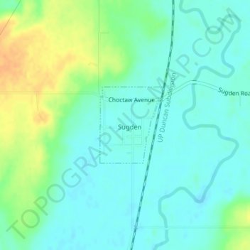
Name: Sugden topographic map, elevation, terrain.
Location: Sugden, Jefferson County, Oklahoma, United States (34.07810 -97.98228 34.08635 -97.97390)
Average elevation: 266 m
Minimum elevation: 255 m
Maximum elevation: 290 m
Other topographic maps
Click on a map to view its topography, its elevation and its terrain.
Ryan
United States > Oklahoma > Jefferson County
Ryan, Jefferson County, Oklahoma, 73565, United States
Average elevation: 267 m
Oscar
United States > Oklahoma > Jefferson County
Oscar, Jefferson County, Oklahoma, United States
Average elevation: 260 m
Petersburg
United States > Oklahoma > Jefferson County
Petersburg, Jefferson County, Oklahoma, United States
Average elevation: 251 m
Grady
United States > Oklahoma > Jefferson County
Grady, Jefferson County, Oklahoma, United States
Average elevation: 258 m
Cornish
United States > Oklahoma > Jefferson County
Cornish, Jefferson County, Oklahoma, United States
Average elevation: 263 m
Terral
United States > Oklahoma > Jefferson County
Terral, Jefferson County, Oklahoma, United States
Average elevation: 257 m
Ringling
United States > Oklahoma > Jefferson County
Ringling, Jefferson County, Oklahoma, 73456, United States
Average elevation: 270 m
Waurika
United States > Oklahoma > Jefferson County
Waurika, Jefferson County, Oklahoma, 73573, United States
Average elevation: 282 m