
Wansan-gu topographic map
Interactive map
Click on the map to display elevation.
About this map
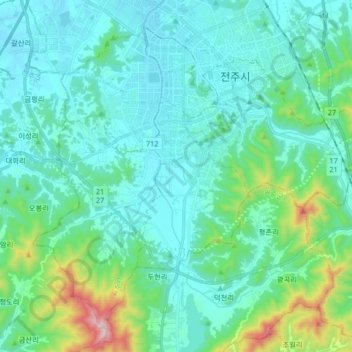
Name: Wansan-gu topographic map, elevation, terrain.
Location: Wansan-gu, Jeonju-si, North Jeolla, South Korea (35.72848 127.05204 35.84231 127.21716)
Average elevation: 138 m
Minimum elevation: 14 m
Maximum elevation: 771 m
Other topographic maps
Click on a map to view its topography, its elevation and its terrain.
Deokjin-gu
Deokjin-gu, Jeonju-si, North Jeolla, South Korea
Average elevation: 96 m