
Deokjin-gu topographic map
Interactive map
Click on the map to display elevation.
About this map
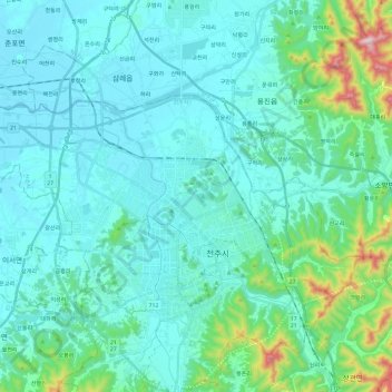
Name: Deokjin-gu topographic map, elevation, terrain.
Location: Deokjin-gu, Jeonju-si, North Jeolla, South Korea (35.80173 126.99619 35.90132 127.23437)
Average elevation: 96 m
Minimum elevation: 2 m
Maximum elevation: 664 m
Other topographic maps
Click on a map to view its topography, its elevation and its terrain.
Wansan-gu
Wansan-gu, Jeonju-si, North Jeolla, South Korea
Average elevation: 138 m