
Mettukadai topographic map
Interactive map
Click on the map to display elevation.
About this map
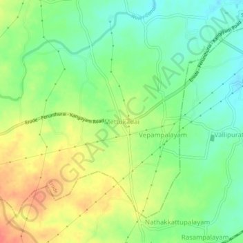
Name: Mettukadai topographic map, elevation, terrain.
Location: Mettukadai, Erode, Erode District, Tamil Nadu, 638012, India (11.27879 77.62926 11.31879 77.66926)
Average elevation: 228 m
Minimum elevation: 205 m
Maximum elevation: 256 m
Other topographic maps
Click on a map to view its topography, its elevation and its terrain.
Chithode
India > Tamil Nadu > Erode
Chithode, Erode, Erode District, Tamil Nadu, 638102, India
Average elevation: 197 m