
Tahoua topographic map
Interactive map
Click on the map to display elevation.
About this map
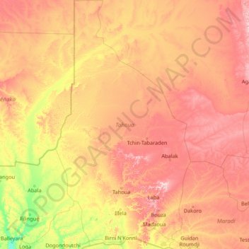
Name: Tahoua topographic map, elevation, terrain.
Location: Tahoua, Niger (13.64475 3.86967 18.68140 6.72538)
Average elevation: 378 m
Minimum elevation: 203 m
Maximum elevation: 737 m
Other topographic maps
Click on a map to view its topography, its elevation and its terrain.
KOREN GUIDAN KADA
KOREN GUIDAN KADA, Madaoua, Tahoua, Niger
Average elevation: 320 m