
New Ireland topographic map
Interactive map
Click on the map to display elevation.
About this map
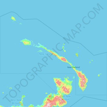
Name: New Ireland topographic map, elevation, terrain.
Location: New Ireland, Islands Region, Papua New Guinea (-5.00000 149.00000 -1.11420 154.00000)
Average elevation: 36 m
Minimum elevation: 0 m
Maximum elevation: 2,268 m
Other topographic maps
Click on a map to view its topography, its elevation and its terrain.
Port Moresby
Papua New Guinea > National Capital District > National Capital District
Average elevation: 34 m