
Westport-Belmullet Municipal District topographic map
Interactive map
Click on the map to display elevation.
About this map
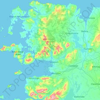
Name: Westport-Belmullet Municipal District topographic map, elevation, terrain.
Average elevation: 62 m
Minimum elevation: -1 m
Maximum elevation: 788 m
Other topographic maps
Click on a map to view its topography, its elevation and its terrain.
Ballina Municipal District
Ballina Municipal District, County Mayo, Connacht, Irland
Average elevation: 74 m