
Acaill topographic map
Interactive map
Click on the map to display elevation.
About this map
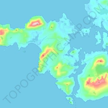
Name: Acaill topographic map, elevation, terrain.
Location: Acaill, County Mayo, Connacht, F28X018, Irland (53.87408 -10.25877 54.03020 -9.91432)
Average elevation: 42 m
Minimum elevation: -2 m
Maximum elevation: 659 m
Other topographic maps
Click on a map to view its topography, its elevation and its terrain.
Westport-Belmullet Municipal District
Westport-Belmullet Municipal District, County Mayo, Connacht, Irland
Average elevation: 62 m
Ballina Municipal District
Ballina Municipal District, County Mayo, Connacht, Irland
Average elevation: 74 m