
Thank you for supporting this site ❤️
Make a donation
Make a donation
Mousa topographic map
Click on the map to display elevation.
Thank you for supporting this site ❤️
Make a donation
Make a donation
About this map
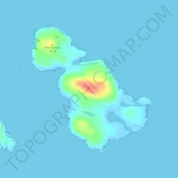
Name: Mousa topographic map, elevation, terrain.
Location: Mousa, Shetland, Scotland, United Kingdom (59.98941 -1.19335 60.00858 -1.15829)
Average elevation: 3 m
Minimum elevation: -2 m
Maximum elevation: 54 m
Thank you for supporting this site ❤️
Make a donation
Make a donation