
Thank you for supporting this site ❤️
Make a donation
Make a donation
Quill Lake topographic map
Click on the map to display elevation.
Thank you for supporting this site ❤️
Make a donation
Make a donation
About this map
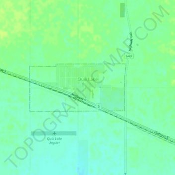
Name: Quill Lake topographic map, elevation, terrain.
Location: Quill Lake, Saskatchewan, S0A 3E0, Canada (52.06743 -104.26829 52.07484 -104.24406)
Average elevation: 539 m
Minimum elevation: 532 m
Maximum elevation: 545 m
Thank you for supporting this site ❤️
Make a donation
Make a donation
Other topographic maps
Click on a map to view its topography, its elevation and its terrain.
Saskatoon
Canada > Saskatchewan > Saskatoon (city) > Saskatoon
Saskatoon lies on a long belt of rich, potassic chernozem in middle-southern Saskatchewan and is found in the aspen parkland biome. The lack of surrounding mountainous topography gives the city a relatively flat grid, though the city does sprawl over a few hills and into a few valleys. The lowest point in the…
Average elevation: 510 m